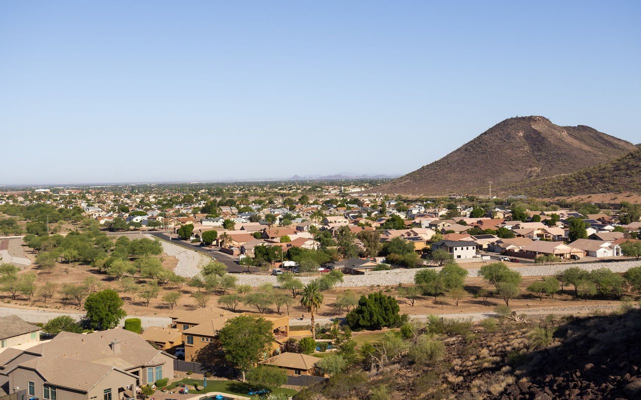
An incorporated City in Maricopa County, in the Phoenix West Valley, bordering Phoenix's western edge. William John Murphy — who built the Arizona Canal (completed 1885) and founded the Arizona Improvement Company (1887) — is credited as Glendale's founder; he built Grand Avenue as an 18-mile diagonal road linking Phoenix to Peoria and chose the name "Glendale" for the townsite. In 1891, colonizer Burgess A. Hadsell recruited roughly 70 Brethren/River Brethren families to settle the area, and the original townsite was platted in 1895. A beet sugar factory (1906–1913) drove early agricultural growth.
Glendale incorporated as a Town on June 18, 1910, with A.W. Bennett as its first mayor, and became a City in 1930. It is confirmed to currently be an incorporated City, operating under a Council-Manager form of government per its City Charter, with a seven-member Council (a Mayor elected at-large plus six district representatives).
Population figures vary by source and year:
Land area also varies by source: 61.60 sq mi (U.S. Census Bureau, 2020) versus 64.68 sq mi (Wikipedia, citing 2020 Census geography) versus 67 sq mi (a city-sourced figure via Ballotpedia). The Census Bureau figure is used here as the primary reference.
Glendale borders Phoenix, Peoria, Tolleson, and El Mirage, and is near Litchfield Park.
Verified as located within Glendale city limits:
Excluded: "Stonegate" is located in Scottsdale, not Glendale — likely a name confusion with "Stonehaven."
Full calendar-year data, refreshed once a year. Source link
Glendale | Altos report: Glendale, AZ (citywide)
Metric | Value |
|---|---|
Population | 226,721 (2010 Census) → 248,325 (2020 Census) → 260,572 (July 2025 Census estimate) |
Median Home Price | [ ] |
Median Days on Market | [ ] |
Active Listings | [ ] |
Year-over-Year Price Change | [ ] |
Price per Square Foot | [ ] |
Glendale is served by multiple, overlapping school districts — no single district covers the entire city:
Glendale Community College — confirmed physically located in Glendale, with a Main Campus at 6000 W Olive Ave and a North Campus at 5727 W Happy Valley Rd; part of the Maricopa County Community College District.
Westgate Entertainment District — adjacent to State Farm Stadium, home to dozens of restaurants including Salt Tacos y Tequila, Kabuki Japanese Restaurant, Throne Brewing Company, Bar Louie, First Watch, Dapper & Stout Coffee Company, The Tipsy, Caramba Mexican Food, Tulum Modern Mexican, Manna Korean BBQ, Buffalo Wild Wings, Chicken N Pickle, Five Guys, Yard House, Hot N Juicy Crawfish, and Dave & Buster's.
Excluded/misattributed: The Ostrich Festival is a Chandler, AZ event (East Valley) and is not associated with Glendale. A "Glendale Jazz Festival" could not be verified as a separately-branded event; the verified, sourced event is the Arizona Jazz Festival, held in Glendale.
Seven regional parks/park systems are officially designated by the City of Glendale:
Is Glendale a City or a Town? Glendale is an incorporated City. It was originally incorporated as a Town in 1910 and became a City in 1930.
What school district serves Glendale? Glendale is served by multiple overlapping districts, including Glendale Union High School District, Glendale Elementary School District, Pendergast Elementary School District, Deer Valley Unified School District, and Peoria Unified School District, depending on the specific location within the city.
Is Arrowhead Ranch/Arrowhead Towne Center in Glendale or Peoria? Both are located within Glendale city limits, despite sitting near the Peoria border, which is a common source of confusion.
What professional sports teams play in Glendale? The Arizona Cardinals (NFL) play at State Farm Stadium. The Los Angeles Dodgers and Chicago White Sox hold spring training at Camelback Ranch. The Arizona Rattlers and Arizona Ridge Riders play at Desert Diamond Arena.
252,833 people live in Glendale, where the median age is 34.6 and the average individual income is $33,919. Data provided by the U.S. Census Bureau.
Total Population
Median Age
Population Density Population Density This is the number of people per square mile in a neighborhood.
Average individual Income
There's plenty to do around Glendale, including shopping, dining, nightlife, parks, and more. Data provided by Walk Score and Yelp.
Explore popular things to do in the area, including Hartsell Home Baked Goods, Arzon Water, and My Taste of South.
| Name | Category | Distance | Reviews |
Ratings by
Yelp
|
|---|---|---|---|---|
| Dining | 0.27 miles | 0 reviews | 0/5 stars | |
| Dining | 0.66 miles | 0 reviews | 0/5 stars | |
| Dining | 0.82 miles | 0 reviews | 0/5 stars | |
| Dining | 0.82 miles | 1 review | 5/5 stars | |
| Dining | 1.14 miles | 0 reviews | 0/5 stars | |
| Shopping | 1.63 miles | 0 reviews | 0/5 stars | |
| Active | 0.27 miles | 0 reviews | 0/5 stars | |
| Active | 0.27 miles | 0 reviews | 0/5 stars | |
| Active | 1.5 miles | 0 reviews | 0/5 stars | |
| Beauty | 0.27 miles | 0 reviews | 0/5 stars | |
| Beauty | 0.27 miles | 0 reviews | 0/5 stars | |
| Beauty | 0.43 miles | 0 reviews | 0/5 stars | |
| Beauty | 0.46 miles | 0 reviews | 0/5 stars | |
| Beauty | 0.46 miles | 0 reviews | 0/5 stars | |
| Beauty | 0.49 miles | 1 review | 5/5 stars | |
| Beauty | 0.61 miles | 0 reviews | 0/5 stars | |
| Beauty | 0.61 miles | 0 reviews | 0/5 stars | |
| Beauty | 0.89 miles | 0 reviews | 0/5 stars | |
| Beauty | 1.21 miles | 0 reviews | 0/5 stars | |
| Beauty | 1.3 miles | 0 reviews | 0/5 stars | |
| Beauty | 1.4 miles | 1 review | 1/5 stars | |
| Beauty | 1.44 miles | 0 reviews | 0/5 stars | |
| Beauty | 1.44 miles | 0 reviews | 0/5 stars | |
| Beauty | 1.51 miles | 2 reviews | 5/5 stars | |
|
|
||||
|
|
||||
|
|
||||
|
|
||||
|
|
||||
|
|
Glendale has 88,633 households, with an average household size of 2.8. Data provided by the U.S. Census Bureau. Here’s what the people living in Glendale do for work — and how long it takes them to get there. Data provided by the U.S. Census Bureau. 252,833 people call Glendale home. The population density is 3,767 and the largest age group is Data provided by the U.S. Census Bureau.
Total Population
Population Density Population Density This is the number of people per square mile in a neighborhood.
Median Age
Men vs Women
Population by Age Group
0-9 Years
10-17 Years
18-24 Years
25-64 Years
65-74 Years
75+ Years
Education Level
Total Households
Average Household Size
Average individual Income
Households with Children
With Children:
Without Children:
Marital Status
Blue vs White Collar Workers
Blue Collar:
White Collar: