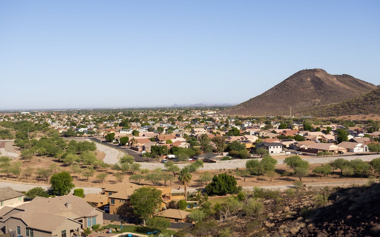
An incorporated City in the northwest Phoenix metro area (West/Northwest Valley), roughly a 30-minute drive northwest of downtown Phoenix. The first residents (the Straw family) settled the site in November 1886, recruited from Peoria, Illinois by William J. Murphy, who had worked on the Arizona Canal; the settlement's name derives from a Miami-Illinois word carried over from Peoria, Illinois, described by one source as a corruption of the word for "prairie fire." A post office was established August 4, 1888. Additional early developers named in the City's own historic timeline include Joseph B. Greenhut and Deloss S. Brown, who acquired land in 1890 under the Desert Lands Act and platted the townsite.
The exact plat-filing date has two conflicting sources: Wikipedia states May 24, 1897, while the City of Peoria's own historic-preservation timeline states March 24, 1897. This should be confirmed with the City before publishing a specific date elsewhere.
Peoria was officially incorporated as a City on June 7, 1954, with a population of 1,925 residents on 720 acres.
Population figures by year:
Total land area is approximately 179.2 square miles (176.1 sq mi land, 3.2 sq mi water). Peoria is confirmed to span two counties — the great majority of the city sits in Maricopa County, with a portion in the north extending into Yavapai County.
Peoria is bordered by Glendale, Sun City, and Surprise.
Verified via official city, developer, or HOA primary sources:
Flagged/unverified: "Westwing Mountain" appears consistently across real estate listings as a named Peoria neighborhood, but no official city planning document or dedicated HOA site could be located to confirm it in this pass — recommend verifying against city GIS/plat records before treating it as confirmed.
Important correction — Sun City and Sun City West are NOT part of Peoria. Both are separate, unincorporated Maricopa County census-designated places (CDPs), bordering Peoria but governed by their own resident/homeowner associations (the Sun City Homeowners Association and the Property Owners and Residents Association, respectively) rather than a municipal government. They should never be described as Peoria neighborhoods.
Full calendar-year data, refreshed once a year. Source link
Peoria | Altos report: Peoria, AZ (citywide)
Metric | Value |
|---|---|
Population | 108,364 (2000) → 154,065 (2010) → 190,985 (2020) → 200,881 (July 2025 estimate) |
Median Home Price | [ ] |
Median Days on Market | [ ] |
Active Listings | [ ] |
Year-over-Year Price Change | [ ] |
Price per Square Foot | [ ] |
Nadaburg Unified School District (northwest portions) and Wickenburg Unified School District (the Yavapai County portion) are also reported to serve parts of Peoria via secondary sources, but this has not been independently confirmed against each district's own site.
P83 Entertainment District (83rd Ave & Bell Rd corridor):
Important correction — Lake Pleasant Regional Park is not within Peoria city limits. Although frequently marketed as a Peoria-area attraction, its official mailing address (41835 N. Castle Hot Springs Rd.) places it in unincorporated Morristown, AZ, and it is operated by the Maricopa County Parks and Recreation Department, not the City of Peoria. It is more accurate to describe it as "near Peoria" or "in the Peoria area, accessed via Carefree Highway" rather than stating it is located in Peoria. Recreational activities confirmed there include boating, fishing, camping, hiking, swimming, water skiing, and a Discovery Center.
Are Sun City and Sun City West part of Peoria? No. Both are separate, unincorporated Maricopa County communities bordering Peoria, governed by their own resident associations rather than a Peoria city government.
Is Lake Pleasant Regional Park located in Peoria? Not within city limits — the park's official address places it in unincorporated Morristown, AZ, and it is operated by Maricopa County Parks and Recreation, though it is commonly described as being in the Peoria area.
What school district serves Peoria? Peoria Unified School District is the primary district; Deer Valley Unified School District also serves a portion of the city.
Which MLB teams hold spring training in Peoria? The San Diego Padres and Seattle Mariners train at the Peoria Sports Complex, with leases confirmed through 2034.
196,906 people live in Peoria, where the median age is 41.7 and the average individual income is $47,834. Data provided by the U.S. Census Bureau.
Total Population
Median Age
Population Density Population Density This is the number of people per square mile in a neighborhood.
Average individual Income
There's plenty to do around Peoria, including shopping, dining, nightlife, parks, and more. Data provided by Walk Score and Yelp.
Explore popular things to do in the area, including Cierra's Bake Shoppe, BBM’s Bites and Brew, and Jamia.
| Name | Category | Distance | Reviews |
Ratings by
Yelp
|
|---|---|---|---|---|
| Dining | 0.76 miles | 0 reviews | 0/5 stars | |
| Dining | 0.76 miles | 0 reviews | 0/5 stars | |
| Dining | 0.76 miles | 0 reviews | 0/5 stars | |
| Dining | 0.76 miles | 0 reviews | 0/5 stars | |
| Dining | 0.76 miles | 0 reviews | 0/5 stars | |
| Dining | 0.76 miles | 0 reviews | 0/5 stars | |
| Dining | 0.76 miles | 0 reviews | 0/5 stars | |
| Dining | 0.76 miles | 0 reviews | 0/5 stars | |
| Dining | 0.76 miles | 3 reviews | 2.3/5 stars | |
| Dining | 0.76 miles | 0 reviews | 0/5 stars | |
| Shopping | 0.76 miles | 0 reviews | 0/5 stars | |
| Active | 0.76 miles | 0 reviews | 0/5 stars | |
| Active | 0.76 miles | 1 review | 5/5 stars | |
| Active | 0.76 miles | 0 reviews | 0/5 stars | |
| Active | 0.76 miles | 0 reviews | 0/5 stars | |
| Active | 0.76 miles | 2 reviews | 5/5 stars | |
| Active | 0.76 miles | 0 reviews | 0/5 stars | |
| Beauty | 0.76 miles | 0 reviews | 0/5 stars | |
| Beauty | 0.76 miles | 0 reviews | 0/5 stars | |
| Beauty | 0.76 miles | 0 reviews | 0/5 stars | |
| Beauty | 0.76 miles | 0 reviews | 0/5 stars | |
| Beauty | 0.76 miles | 1 review | 5/5 stars | |
| Beauty | 0.76 miles | 1 review | 5/5 stars | |
| Beauty | 0.76 miles | 0 reviews | 0/5 stars | |
|
|
||||
|
|
||||
|
|
||||
|
|
||||
|
|
||||
|
|
Peoria has 73,824 households, with an average household size of 2.64. Data provided by the U.S. Census Bureau. Here’s what the people living in Peoria do for work — and how long it takes them to get there. Data provided by the U.S. Census Bureau. 196,906 people call Peoria home. The population density is 1,114 and the largest age group is Data provided by the U.S. Census Bureau.
Total Population
Population Density Population Density This is the number of people per square mile in a neighborhood.
Median Age
Men vs Women
Population by Age Group
0-9 Years
10-17 Years
18-24 Years
25-64 Years
65-74 Years
75+ Years
Education Level
Total Households
Average Household Size
Average individual Income
Households with Children
With Children:
Without Children:
Marital Status
Blue vs White Collar Workers
Blue Collar:
White Collar: